In Cappadocia, if you are interested in Turkish carpets we can also visit one of the local carpet workshops and view the traditional carpet-making process.
Carpet weaving is one of the oldest professions in the world. In central Asia, people wove carpets and kilims in order to protect themselves from the cold climate. The art of Turkish carpet weaving first started in central Asia. The oldest known knotted carpet (5th century BC) was discovered in the Pazyryk valley, about 5000 feet up on the Altai Mountains in Siberia.
But carpets reflect the culture of a people and often open our eyes to the way women who had little way of expressing their desires or their frustations could show it through their weaving designs.
Reading a Turkish carpet is fascinating as you think of the young girl on her loom who is in fact using age-old symbols and designs but is writing her personal diary. Knotting in her fear of her future mother-in-law or her hopes for the future – children, long life, prosperity. Buying a hand-knotted carpet with a unique design is not just a way of decorating your dining-room – it also a way of preserving history and helping to continue these ancestral traditions.
Traveling to Cappadocia ?
If you’re planning to go to Cappadocia, we have some important information about when to go, what to wear, and what to pack.
June in Cappadocia has been described as beautiful with beautiful warm nights as well as beautiful hot days. Cappadocia cools down at night during the year, sometimes to a temperature that is too cold and cool, however, in June it cools down to a pleasant summer evening temperature. The end of June brings much hotter temperatures but definitely not the hottest temperatures in Türkiye . If you like the heat without it being too hot, June is the best month to visit Cappadocia!
The temperature reaches around 24℃ during the daytime in June, falling away to 13℃ at night. The UV index will be high at this time of year, so protection against skin and eye damage is needed. Try to limit exposure between 10am and 4pm. Apply broad spectrum SPF 30+ sunscreen every few hours, even if it’s cloudy, or more frequently after sweating or swimming, and wear UV-blocking sunglasses too, and bear in mind that bright surfaces, such as sand and water increase UV exposure.
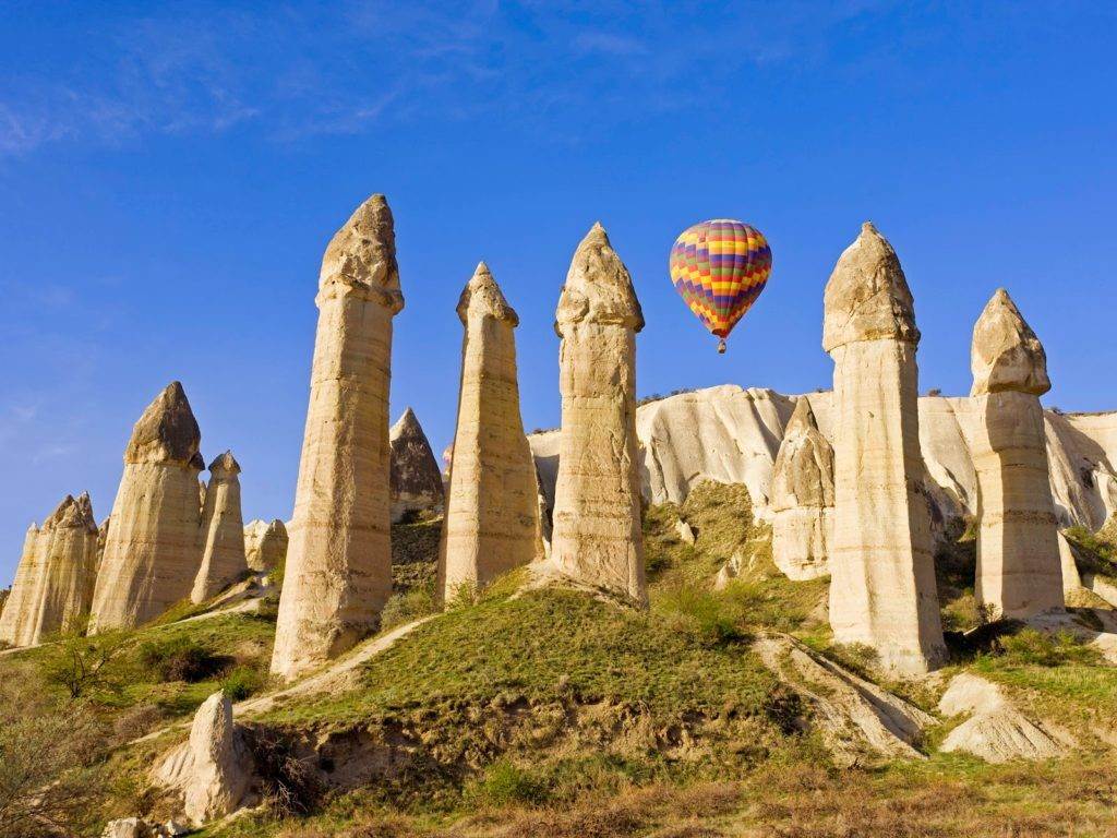
Sometimes weird can be truly beautiful. Cappadocia’s weird landscape is what makes it magical. Its strange beauty is unique and I doubt if you will ever see a place like this anywhere else on the planet. Perhaps Mother Nature was on LSD when she created Cappadocia.

The correct way to describe Cappadocia’s landscape is actually “Moonscape” because it looks otherworldly. You may not ever get a chance to visit another planet, but a visit to Cappadocia will make you forget you’re on Earth.
Just look at this picture – how can this be real? (but it is!). As per me, this is truly magical.
In case you’re curious, these strange formations exist because of volcanic eruptions and were carved beautifully by the wind. Yes, erosion can be pretty too.
One of the best ways to enjoy the beauty of Cappadocia’s moonscape is by flying over it. Yes, it’s expensive but Cappadocia is one of the cheapest locations in the world to experience a hot air balloon ride. It may be cheaper than the most but it is definitely the most beautiful one.
A hot air balloon ride experience is a must do in every single Türkiye itinerary. It normally costs around $200, which includes a pickup, breakfast, the ride itself, champagne and a drop back to the hotel. There are many tour operators that offer this but since it can be risky, I’d suggest you pick the best.
If Cappadocia wasn’t magical enough, things get better because there are caves everywhere, even inside the weird rock formations.
These caves were built many centuries ago and some are still inhabited. Of course, most of them have turned into hotels, so if you can have your own cave when you visit Cappadocia.
Thankfully, these cave hotels are not just for the rich travelers and are for literally every budget. Even some hostels are built inside them! The best thing is that the interiors stay cool and it feels like a natural air conditioner.
The sun rises here at 4:30 am in summers and the view is worth a million dollars.
It’s beautiful to see how the colors change from orange to beige and the sky gets bejeweled by hundreds of hot air balloons! This sight is magical enough to make anyone forget the real world.
Cappadocia is stunning not just above the surface, but also beneath the ground. There are underground cities that were created many centuries ago and some of them are more than ten levels deep. And no, these were not just used as temporary places of shelter but people lived here permanently. Wow!
It gets even stranger – more than 200 underground cities have been discovered in Cappadocia,only 40 are to visit and some of them are connected to each other via tunnels. These were hidden for many years and one of the biggest was discovered in 2014. As per some archeologists, they were created in the 1200s BC. Whoa!
If you’re a sucker for viewpoints, then Cappadocia will not disappoint you. It’s landscape is hilly, which makes it easy to find elevated areas where you can chill for hours and enjoy the view. I never had to research about or hunt for a viewpoint while I was there. I found a few while exploring on my own.
Some of the most popular viewpoints are Goreme’s sunset point, Uchisar castle, Three Sister Rock panorama point and Red Valley sunset point. In fact, the last one is so magical, that people actually come here for wedding shoots.
Cappadocia is not just a summer destination but it can be enjoyed through out the year. It came to me as a surprise that it snows in Cappadocia in the winters. Cappadocia’s weather is unpredictable and it has been known to snow in March too! Here’s another picture that will surely steal your heart.
Cappadocia is massive and even if you spend a week here, you will barely just touch the surface. There is a love valley (Zemi valley), red valley, rose valley,Fantasie valley, Ihlara valley, pigeon valley, and many other valleys. You can go hiking, mountain biking, horseback riding, historical tours, culture tours and what not.
Yes, there are many things to do in Cappadocia so you will definitely not be bored when you visit it. Honestly, you don’t really have to do everything here but you can just chill and explore your surroundings at your own pace.
You can also explore Cappadocia’s stunning art shops, cave monasteries, Uchisar palace
Haha – this point is especially relevant for new bloggers because it is difficult to take a bad photo in Cappadocia.

Cappadocia region was formed 60 million years ago by erosion of soft layers of lava and ash from Mount Erciyes (Argeus), Mount Hasan and Mount Güllü composing with wind and rain over millions of years.
Human settlement at the Cappadocia region dates back to the Paleolithic era. The lands where the Hittites once lived have been one of the most important centers of Christianity in the later periods. Houses and churches carved into the caves and rocks turned the region into a huge heaven for Christians escaping from the dominance of the Roman Empire.
Cappadocia is a region spreading an area covering the provinces particularly to Nevsehir, Kirsehir, Nigde, Aksaray and Kayseri.
The region of Cappadocia is a place where nature and history integrates. While geographical events created fairy chimneys – the people carved houses and churches inside these chimneys. Later on decorated them with frescoes in this historical process, bringing the traces of civilizations for thousands of years to present. Written history of Cappadocia, where human settlement dates back to the Paleolithic era, begins with the Hittites. Hosting trade colonies throughout history and founding commercial and social bridges between countries, Cappadocia was one of the important junctions of the Silk Road.
In the 12th century BC, a dark period began in the region with the collapse of the Hittite Empire. During this period, the late Hittite Kings with effects of Assyria and Phrygia ruled the region. These Kingdoms lasted until the Persian invasion in the 6th century BC. The word used today, Cappadocia, means “Land of Beautiful Horses” in Persian. In 332 BC, Alexander the Great defeated the Persians and encountered great resistance in Cappadocia. During this period, the Kingdom of Cappadocia was established. The Roman power began to be felt in the region towards the end of the 3rd century BC. In the middle of 1st century, Kings of Cappadocia were appointed and toppled from the throne by the Roman Generals. When the last king of Cappadocia died in 17 AD, the region became a province of Rome.
In the 3rd century, Christians came to the Cappadocia which became a centre for education. Pressure on the Christians increased between 303-308. But Cappadocia was an ideal place to be safeguarded from pressures and to spread the Christian doctrine. Deep valleys and shelters dug into the soft volcanic rocks created a safe heaven against the Roman soldiers.
The 4th century is the period of the people known as “Fathers of Cappadocia.” But the importance of the region reached its climax when Leon III, Emperor of Rome banned icons. Under these circumstances, some people who were pro-icon started to take shelter in the region. Iconoclasm movement lasted more than a hundred years (726-843). Although some Cappadocian churches were under the influence of Iconoclasm in this period, pro-icon people easily continued worshipping here. The monasteries of Cappadocia developed considerably during this period.
Again, in these periods, Arab raids started to affect the Christian regions in Anatolia, from Armenia to Cappadocia. People escaping the invasion and coming to the region changed the styles of churches in the area. In 11th and 12th centuries Cappadocia passed into the hands of the Seljuk Turks. The region spent a period without trouble subsequent times under the Ottoman Empire. The last Christians in the region migrated from Cappadocia due to the exchange of Treaty of Lausanne in 1924-26, leaving beautiful architectural examples behind.
Tourism in Cappadocia
The region nowdays has a great importance in terms of Tourism. The main worthseeing places are Ürgüp, Avanos, Göreme, Akvadi, Uçhisar and Ortahisar Castles, El Nazar Church, Aynalı Church (The Church with Mirrors) Güvercinlik Valley, Derinkuyu, Kaymaklı, Özkonak underground cities, Ihlara Valley, Selime Village, Çavuşin, Güllüdere Valley, Paşabağ and Zelve.
Traditional Cappadocian houses and dovecotes carved into caves reflect the uniqueness of the region. These houses have been constructed on hillsides by using rocks mainly in the 19th century. The Cappadocian Rock, is the only construction material of the region, as it is very soft after quarry due to the structure of the region, it can be easily processed but after contact with the air it hardens and turns into a very strong construction material. As a result of this easy and unique process, regional stonework is developed and turned into an architectural tradition. Upper parts of the doors built with arches are decorated with stylized ivy or rosette motifs. Dovecotes within the region are small structures constructed in 18th century and in the later of 19th century. Some of the dovecotes, which are important for showing Islamic picture art, had been constructed as monastery or church. Regional artists decorated the surfaces of dovecotes with rich inscriptions and adornments. The region is also famous for winemaking and grape growing.
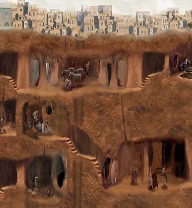
One of the most interesting and exciting cultural activities in Cappadocia is underground cities. If we think about all of the villages and towns in Cappadocia, total of 25.000 km2, and underground cities beneath them, we can easily assume there are more underground cities than we know. And it’s unique underground network is not found anywhere in the world.The underground cities of Cappadocia were built by carving the rocks down on volcanic tuff land. We still don’t know how they manage to carve this deep underground considering there were no technologic equipments. To identify their age, the traces left by ancient civilizations are used.
Because of raids and attacks on Cappadocia area, there are hidden rooms and secret passages beneath almost every house that can be used as a protection. This situation transformed aboveground villages into underground villages. And with the tunnels that connect villages to each other it has transformed into underground cities. Food warehouses that can feed thousands of people for a long time, water wells, chimneys providing uninterrupted ventilation, toilets and places of worship are all evidences of excellent design of Cappadocia Underground Cities which often makes us think “Is there Ufo stuff in this business”?
First written source about Cappadocia Underground Cities is a book called Ksenephon’un Anabasis (Return of the Thousands). Ksenephon is a Greek historian and world’s first war reporter who fought in with the Isparta Army against a war with Artakserkses, the King of Iran. In his book, which he wrote in the 400s BC, he wrote that the Isparta army was tired and stayed in the underground cities of Kaymaklı and Derinkuyu. Rock reliefs belonging to the Hittite civilization, founded 2000 years before the birth of Jesus, and the underground tunnels they built for defense prove the oldness of its past. Then first Christians arrives and underground cities becomes deeper and wider as a protection against Arabian raids. According to the German origin Martin Urban, who came to Cappadocia in 1970s and made a comprehensive research, the age of the underground cities of Cappadocia was back to 7 – 8 BC.
The first of Cappadocia’s deepest, widest and most amazing underground cities is Derinkuyu Underground City. Located on the Nevşehir – Niğde road and 30 km from Nevşehir, the underground city is located in Derinkuyu district. It has discovered in 1963, partly cleaned and opened for visitors in 1967. Right now it has 8 open floor that reaches 50 meters down, but if all of it is cleaned, its floors can be up to 12-13 and reaches a depth of 85 meters. This Cappadocia Underground City has total of 2,5 km cleaned, visitable area called after 52 water wells inside of it. These water wells are 60 – 70 meters deep and both meets the need for water supply and functions as a ventilation shaft. Some of these chimneys have no connection with the surface in order to prevent the enemy, which cannot come down during the sieges in the region, from mixing poison with water. This feature is one of the reasons why this Cappadocia underground city, which is so sheltered and equipped with a natural ventilation system, does not have a technological explanation.

Even if Cappadocia Underground Cities have similar features with their purpose and architecture, you will encounter higher equipment while visiting Derinkuyu Underground City. The floors of the underground city, which has a very uncertain entrance from the outside, are interconnected by narrow corridors. In order to prevent entry in case of danger, precautions were taken with huge round stones such as millstones that can be moved by pulling.
While living spaces, dining halls, kitchens, stables, mysteries and cisterns are places that can be seen in almost every Cappadocia underground city, there is also a missionary school whose ceiling is covered with barrel vaults in the region. The cross-shaped church is carved on the 2nd floor of the underground city and can be reached by going down the stairs from the 3rd and 4th floors.
It is believed that approximately 15 thousand people can live at the same time in Derinkuyu Underground City, where the first settlement dates back to the Assyrian Colonies and the first Christians were escaped from persecution and oppression. Of course we have to say that its narrow tunnels and depth can create claustrophobia, but it is one of the
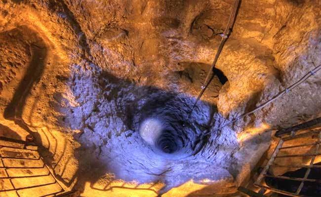
One of the biggest Cappadocia Underground Cities is Kaymaklı Underground City. This underground city, which is almost half the size of Derinkuyu Underground City, is located in Kaymaklı Town, 20 km away from Nevşehir, and has been among UNESCO World Cultural Heritage since 1984. Its history is back to 8 BC Phrygian period and its reason was also to prevent Hittites and Arabian raids.
Although its actual depth reaches up to 8 floors, 4 floors of Kaymaklı Underground City are now open to visitors. The first floor was reserved for stables to make it easier for animals to go out, and passages were opened through the corridors opening from the stables to churches and other living areas. The entrance to the church on the 2nd floor, which was built with 2 apses and one nave, was controlled by sliders. When you enter the church, you will see the baptism stone placed in front of the apses and sitting platforms carved on the edges and you will encounter graves that are thought to belong to the church workers. Living areas, sitting, sheltering, and food rooms are spread over the 3rd and 4th floors.
One of the most interesting places in Kaymaklı Underground City will be the copper processing workshop. And you will encounter holes for iron hammering at the base in these workshops. Kaymaklı Underground City where all the places gather around the ventilation shafts has opened to visitors in 1964. Although it is thought to be related to Derinkuyu Underground City, hidden tunnels within 10 km distance have not been found yet. It is thought that this underground city was one of the biggest and 5 thousand people can live here at the same time.
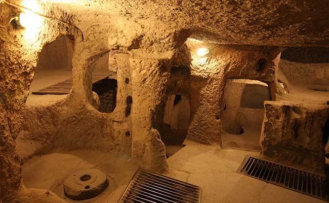
Özkonak Underground City, which is 14 km away from Nevşehir Avanos, was built on the northern slope of İdiş Mountain where the tuff layer is the most intense. You will feel like going down in an apartment while visiting this Cappadocia underground city which has opened to visitors in 1972. Labyrinth tunnels, which are the main factors of connection between places in Cappadocia Underground Cities, are also exists here. The main difference of this city comparing to Derinkuyu and Kaymaklı underground cities is 5-8 cm small capillary holes opened for communication and ventilation. When the doors of the places are closed with sliding stones, the whole worldly connection is provided with these holes. Unlike other underground cities, the sliding stones were made not only for protection but also for fighting. After the entrance was closed with stones, small holes were carved on the tunnel to spear the enemy and pour hot oil.
The first floor of Özkonak Underground City, which has 4 floors, is divided into barns as the others, and the other floors are divided into sections such as living rooms, pantry, grape house and kitchen. The distance between the entrance and the exit is 10 kilometers wide, and it is believed that this underground city’s age is back to the 400s BC and is related to the Hittites.
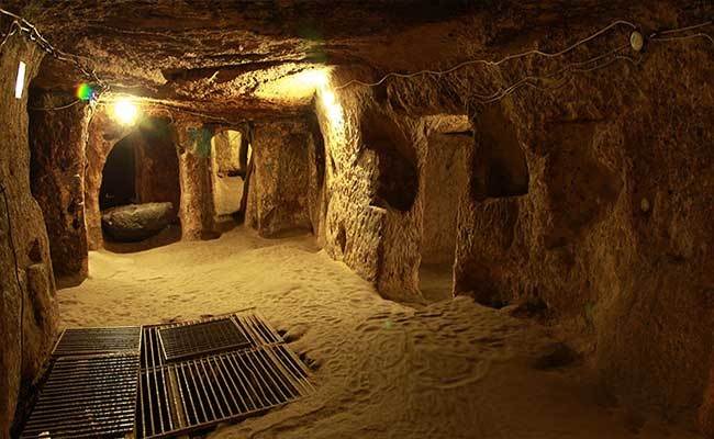
Although discovered in 1975, Tatlarin Underground City, which was opened to visitors in 1991, is 10 km north of Acıgöl town of Nevşehir. And it is in a hill called ‘Castle’ in Tatlarin Town.
Like the other underground cities of Cappadocia, the living spaces are connected to each other with tunnels in this underground city. The large warehouses and churches in Tatlarin Underground City suggest that this may be a military garrison or a monastery complex, not a civilian settlement.
Although the main entrance of the underground city, which has 3 entrances, has been destroyed, you reach a large hall with a passage of 15 meters. Even if you can enter the hall of the underground city with a ticket today, it was a place that not everyone can enter and it has closed with perforated sliding stones when used. 3 skeletons were found in the stairs of the hall while cleaning. As if it resembles today’s home structure, there is a toilet and kitchen around the same place.
There are barns with strong columns in the second entrance. Sliding stone was used in the barn section with 5 warehouses on the floor and ventilation holes on the ceiling. Tatlarin Underground City which is the answer to question ‘Where is the first underground toilet in the world?’ has two of its rooms opened to visitors.
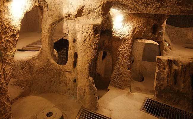
Mazı Underground City, which is 10 km east of Kaymaklı Underground City in Nevşehir and 18 km south of Ürgüp, takes its name from the village where it is located. It was found by chance by a shepherd in 1995 and opened to visitors. The main meaning of Mazı is ‘Ancient City’ and there are many rock tombs from the Early Roman and Byzantine periods in the valley where the village was founded.
The 8-floor underground city has entrances from 4 different locations and is covered with sliding stones with holes in the middle for lances to protect against enemies. The difference from other examples of barns at the entrance is the troughs carved into the rocks and the width of its areas. This is an indication that Mazı Underground City is home to an advanced society in animal husbandry. According to the estimates, 6,000 people live in Mazı Underground City at the same time.
This Cappadocia underground city also has a 20-meter-deep well, a grape house, a cellar, a kitchen and other living spaces, but its church differs from other underground churches with its magnificence. Across the vertical apse of the church there is a hidden chimney that allows passage to other sections. Small step holes are carved into the chimney for easy climbing. With the magnificence of the church and the large quantity of spaces, it is thought to be as big as Derinkuyu and Kaymaklı. And there are also places that are thought to be used as bathrooms in the underground city.

Özlüce Underground City, which is 6 km west of Kaymaklı Town on the Nevşehir – Derinkuyu road, has taken the name of the village it is in. Unlike other Cappadocia underground cities, it has not been opened to visitors as it has a single floor, it has been carved wider, it cannot be cleaned completely and it also contains the risk of dent.
The entrance area passes to the widest area of the underground city, and to the right of this area are food stores and to the left are sitting areas. In addition, the 2-arched room, made with basalt, is connected to the main rock with 15-meter-long tunnels. This relatively new section, which is thought to have been carved later, was separated from the other places by a 2-meter granite sliding stone at the end of the tunnel. Small cell-type chambers are connected to the galleries, whose bases are very long and trapped. The fact that the tuff layer carved contains different colors, also makes Özlüce Underground City different from the others.
Özlüce Underground City, which is 6 km west of Kaymaklı Town on the Nevşehir – Derinkuyu road, has taken the name of the village it is in. Unlike other Cappadocia underground cities, it has not been opened to visitors as it has a single floor, it has been carved wider, it cannot be cleaned completely and it also contains the risk of dent.
The entrance area passes to the widest area of the underground city, and to the right of this area are food stores and to the left are sitting areas. In addition, the 2-arched room, made with basalt, is connected to the main rock with 15-meter-long tunnels. This relatively new section, which is thought to have been carved later, was separated from the other places by a 2-meter granite sliding stone at the end of the tunnel. Small cell-type chambers are connected to the galleries, whose bases are very long and trapped. The fact that the tuff layer carved contains different colors, also makes Özlüce Underground City different from the others.

The underground city, 35 km west of Gülşehir district of Nevşehir, is located very close to Gökçetoprak village. It was first discovered in 1989 by French researchers. In 1991, it was studied by the Italians.
The difference of Sivasa Gökçetoprak Underground City from other Cappadocia underground cities is its geological structure. There are mudstones at the bottom of the layers where it was carved, large grained tuff in the middle and andesite rocks at the top.
On the floors of the underground city, which is thought to has two floors, quite wide but not properly carved rectangular spaces and long narrow corridors connecting these spaces were found. The entrances of the corridors are covered with rock doors brought from outside and carved according to the width. The underground city which has a water well 15-meters deep and has still water inside, has not completely cleaned yet.
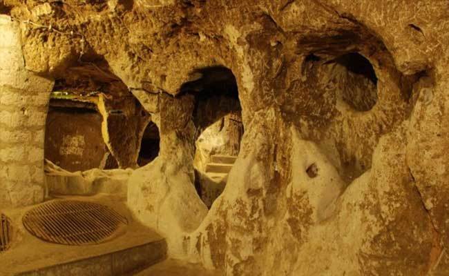
In the vicinity of Gökçetoprak Village, where the underground city is located, many underground cities that are used as barns, haycocks and warehouses are still waiting to come to the light.
SARATLI UNDERGROUND CITY (KIRKGÖZ)
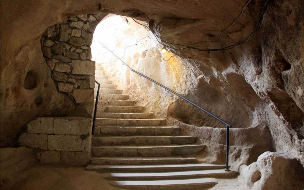
Great masterpiece, secret treasure and bewitching the people with unique historical tissue, Saratli Underground City is located Saratli town in Cappadocia. Symbolizing the deep history, this mystic city is also famous for miraculous architectural structure.
HISTORY
As a result of many excavations, it was figured out that long established history of this magnificent underground city is based on the Rome (Byzantine) Era.
Within those times, the city experienced many events like the Crusades and Arab Invasions which were the very important wars made for religion. Therefore, the peasants built many underground cities around the districts of Cappadocia to protect themselves against the war, attacks and persecution. They established the fascinating Saratlı Underground City as a defence. Those genius locals created a perfect mechanism and a unique handicraft, when they built it by adding secret tunnels connected with each other and ventilation system. Today, this place accompanied by influx of tourists has opened for the visitors after the renovations and excavations in 1950’s.
ARCHITECTURE
This underground city fascinates the numerous domestic and foreign tourists with its architectural style which reflects a fantastic ambiance because it resembles the house of Medusa, mythological character with snake hair in ‘’Clash of the Titans movie’’.
When it is looked at its building, this extraordinary masterpiece has 7 storey, a water well, move to door (kapı tasi), wine cellar, bath, toilet, barn, a kitchen and total 40 splendid rooms.
IHLARA VALLEY
Ihlara Valley Archaeological Site Ihlara Valley, which is located within the boundaries of Güzelyurt district in Aksaray province, has a significant position among the canyons in the world. Unlike all other canyons, Ihlara Valley with a length of 14 kilometres, the depth reaching from place to place to 120 meters and a thousand of habitats has the characteristic of being the biggest canyon in the world where people had lived in history. Ihlara Valley has become one of the most significant culture and civilization centres of the world in the past with hundreds of churches, shelters made by easy excavation of the rocks surrounding the valley and the formation of fairy chimneys. You encounter a unique beauty, fairy chimneys and Selime (goodness) Cathedral, when you exit the valley. The mummies of cats Embalmment was made in the Cappadocia region in the past just like it had been the case in ancient Egypt. A total of 17 mummies have been discovered so far in the Ihlara Valley. While 12 of them are exhibited in Aksaray Museum, the remaining 5 of them are exhibited in Niğde Museum. The mummies generally date back to the 10th and 13th centuries. The embalmment of the cats was practiced in the name of “Bast”, the Goddess with cat head. This ongoing tradition reached to Anatolia and the tradition of embalming the cats was maintained in the Cappadocia region.
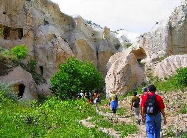
Ağaçaltı Church (Daniel Pantanassa) The central location of the structure with free cross plan is covered by a high hooped dome placed on squinches, the arms of the cross are covered by cradle squinches. The frescoes are dated back to the period before Iconoclasm or the period between 9th and 11th centuries. The figures indicate scenes such as Annunciation, Nativity, Adoration of the three Maggies, Flight into Egypt, Holy Baptism, Koimesis (death of Mary), and Ascension. Kırkdamaltı Church (H. Georgios) It is located in Belisırma Village in Ihlara Valley. The church with irregular hexagonal plan has a flat roof, which is engraved in concave form in the apse direction to the east. The collapsed apse is used as the entrance. Original entrance door is located at northern wall. The church has been decorated by Lady Tamar, wife of Amirarzes Basileios in the period from 1283 to 1295 during which Sultan Mesut II and Emperor Andronikos II were reigning. The figures indicate the scene of Deesis, Metamorphosis, Ascension and the image of Seljuk Sultan Mesut II.
MUSTAFAPASHA( SINASOS)
Mustafapasa is a small town which is in the southeast of Cappadocia and 20km to Goreme. From Seljuk ( 11th century) Age, Rums ( Anatolian Greek Orthodox ) and Turks lived together. Sinasos of Ottoman Period had a great population of Rums. Sinasos was richer than other villages in Cappadocia because most of Rums were trading in Istanbul and they were rich businessmen. It is a fact that minority tended to trade and became richer after the capitulations of Ottoman Age. Together with wealth, a new perspective to life and an understanding of it happened to more modern houses, fascinating buildings and more organized social life. They are the unique qualifications of Sinasos.
Sinasos as ancient name, Mustafapasa for today… It was a sweet and small town in the land of Fairy Chimneys, Cappadocia. Praying from mosques and bell rings from churches applauded themselves when it was only a village. Until the interchange in 1924, 600 Rums ( Anatolian Greek Orthodox ) and 150 Turkish family were living in the town. In various publishing about the event of near past which was named as ”Migration”, ”The interchange of Population”, the situation was impressed and lots of academic works were done.
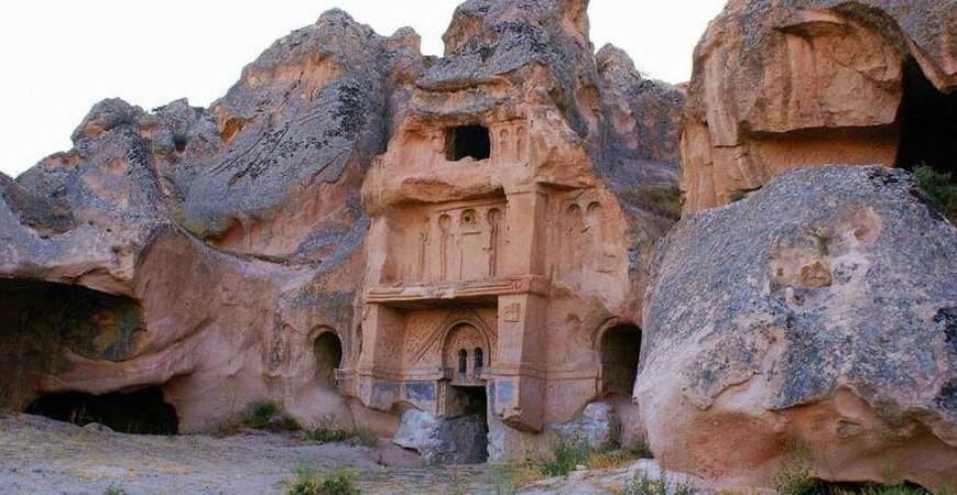
In 30th of January 1923, with the legal arrangement between Turkey and Greece as the headset of ”The agrement and protocol between Turkey and Greece” Muslim People living except west Thracia and Orthodox people living except Istanbul, Bozcaada and Gokceada were interchanged, Even though exact number was unknown, at least two million people were forced to migrate. They left the hometown that they were born and grown. They took everything movable by putting there immovable property. Istead of Rums, exchanged people from Jerveni Village of Castoria city in Greece were replaced.
Living in peace for hundreds of years and sharing the same destiny, Rums and Turks are memorialized in order to pass the cultural heritage down from one generation to another. Exchanged people carried their customs and traditions to Anatolia. It is possible to see it even today. Some of the exchanged people continue to talk Macedonian Language. They also make their meals, play their music and live their customs.
The important churches and monasteries around Mustafapasa are, the church of Aios Vasilos, the church of Constantine-Elene, churches in the monastery valley and, the church of St. Basil in the Gomede valley. There is also a Caravansary built during the Ottoman period and dis- playing fine examples of stone masonry and woodcraft.
his valley is situated near Yesilhisar in the province of Kayseri, 65km southeast of Goreme, and 25km to the east of Derinkuyu Underground City. Its an Earth Crack from 3rt tectonic period (when the continents separated). Fractures and collapses during earthquakes added to erosion resulting in deep valleys and canyons. Soganli valley, which is divided into two, has been occupied since the Roman period. The rock cones found on the sides of the valley were used as graves by the Romans, and later as churches by the Byzantines. The frescoes in the church date back to the 6th – 9th and 13th centuries. Important churches in the valley are Karabas, Yilanli, Kubbeli and the church of St. Barbara
Fine carven has created domes from the rock, and the work on the side walls resembles pointing.The church with its domes, vaults and apses, displays advanced architectural techniques. The upper part of the church has three apses and an upper nave. The church dated to the 10th century.
Scenes: Prophetic Vision, Deesis, Massacre of Innocents, Pursuit of Elizabeth, Annunciation, Visitation, Proof of the Virgin, Nativity, Adoration of the Magi, Flight in to Egypt, Presentation in the Temple, Killing of Zacharias, Calling of John, Baptism, Christ and John, Preaching of John, Baptism, Marriage in Cana, Miracle of the wine, Jesus and the Woman of Samarria, Entry into Jeruselem, and portraits of the saints.
This church is found on the right side of the valley. Bisides the church, graves, large vaulted chapels, and priests’ rooms can be found in this rock mass. The church has one knave, one apse, and a barrel vaulted ceiling.
The 11th century church was painted at varying times, using different techniques.
Scenes: Deesis, Annunciation, Nativity, Presentation in the Tample, Transfiguration, Communion of the Apostles, Crucifixion, Anastasis, Ascension and portraits of saints.
This church lies at the end of the Soganli Valley to the vest of the village. The 10th century church is barrel vaulted and has one nave, and ane apse.
Scenes: Prophetic Vision, on the vault Desis, Annunciation, Visitation, Proof of the Virgin, Journey to Bethlehem, Nativity, Anastasis, Seven Sleepers and Portraits of the saints.
The Heaven and Hell Sinkholes in Mersin were formed by the melting of the calcareous land by an underground river and the collapse of the ceilings of the underground spaces over time. They are also known as Heaven and Hell Caves but it would be more appropriate to consider these structures as sinkholes due to their formation. Because they are the best examples of sinkhole formations formed by the melting of the lower layer and the collapse of the ceiling.
Heaven Sinkhole, is larger in structure than the Hell Sinkhole and it is the one that can be descended into. There is a stone staircase with 452 steps and a historical church on the 300th step. It was built of rectangular block cut stones at the entrance of the cave inside the cliff. There are six arched window openings on the north and south long sides of the building. Inside the building. Prophet. Jesus and his apostles are processed. In the 4-line inscription on the entrance door of the church, it is written that this church was built in the 5th century by a religious person named Paulus, dedicated to the Virgin Mary. It is said that at this location there was another temple from the pagan age. Later this building, also known as the Church of the Virgin Mary, was built at that location. The absence of a roof of the church is also an interesting detail.
After the church is passed, the sinkhole shows the characteristic of a cave and the steps become slippery due to the humid environment. For this reason, you should be careful and sports shoes should be preferred if possible. When you descend 152 more steps, a surprise welcomes the visitors that will make them think that all the trouble is worth it. When attention is paid, the sound of an underground water which is believed to be a mythological river is heard. In fact, this is the stream that forms the Heaven and Hell Cliffs, and it joins the sea in Narlıkuyu bay, and makes the water of this bay ice-cold. When looking back after descending the steps, it impresses the visitors with the gliding of lights, the ambiance of humid air and greenery, and its atmosphere reminiscent of a scene from the movie The Lord of the Rings. Although the exit of the cave is a bit tiring, there are also those who see it as a part of the experience a sense of spiritual achievement when they reach the top.
With the project supported by Çukurova Development Agency in 2018, an elevator was added to Cennet Sİnkhole, so that those who are not in good health or do not want to get tired can get up and down easily. Our advice to the visitors is that choosing the stairs while going down to this sinkhole will make the experience more enjoyable.
Like the Heaven Sinkhole, the Hell was formed as a result of the collapse of the karst land. It is not possible to descend into the sinkhole, whose depth is 128 meters. With the project supported by Çukurova Development Agency, a glass viewing terrace has been built here and it has been ensured that the visitors can watch the scenery more safely.
The story of the Hell Sİnkhole dates back to Greek Mythology. According to the legend, after Zeus defeated the monster Typhon, he imprisoned him here for a while, then locked him under the Etna Volcano forever.
Our advice to the visitors would be to see the Hell, then the Heaven. Going up and down the Heavenl Sinkhole is a bit of a tiring experience, so it is preferable to watch Hell Sinkhole when you are not tired.
CASTE OF ANAMUR:
The Mamure Castle is a medieval castle located 6 km east of the town of Anamur in the city of Mersin in southern Türkiye.
Mamure Castle is also called the Castle of Anamur and was built in 13th century on the site of a fortress built in the 3rd Century AD. You can reach the castle by car and it’s only a 2-hour drive from Alanya.
This detailed guide to Mamure Castle explains everything about the entrance, how to get there, its history, and many other useful tips
Mamure Castle, one of the best preserved castles in the south of Turkey, dates back to the 3rd century BC. It was enlarged during the Byzantine Empire. Although, the castle we are seeing today was built by order of Seljuk Sultan, Alaeddin Keykubat. It was repaired in 1450 by Karamanoglu İbrahim Bey and used until the end of the Ottoman Empire.
Bearing traces from so many civilizations, the castle has various characteristics, with more than a 1500-year history.
Mamure Castle stands near the coast, between two sand beaches. You can easily understand at first glance that this is the ultimate location for protection, as it dominates both the land and the sea.
The area of the fortress surrounded by a moat is 23,500 m². The length of the outer walls of the fortress is about 580 m. There are 39 towers (4 of them are larger than the others) and bastions. The castle has 3 courtyards, all separated from each other by high walls.
The construction material used in the castle was various types of stones and khorasan mortar. Block stones were also used on some windows, entrances, and door edges. Additionally, it is possible to see the traces of later construction using bricks.
Going through the gateway, which still has part of its tierce-point arch, you come into the first courtyard. There is a staircase leading up to one of the towers of the outer enclosure wall. It’s possible to look out over the whole of the fortress from here.
Passing through a slit in the wall, you will reach the second courtyard that is larger than the first. Here you can see a mosque structure that is in good condition. This is an active mosque, which was renovated and currently open for prayers. The first construction of Mamure Mosque, which has the classical elements of the 16th century Ottoman architecture, was carried out during the Karamanids Period.
There is also a fountain and a bath complex in this courtyard.
The Ancient City of Anemurium is also known as Anamuryum, which is Turkish pronunciation among the people. The origin of the word means “Windy Cape”. Anamur District got its name from this ancient city. It is possible to say that it is one of the best preserved ancient cities in Türkiye.
Anemurium Ancient City, which is on one of the southernmost coasts of Turkey, has been seen as a connection point with Cyprus due to its location. Its name first appears on the Romans list of ports in the 4th century. Although it developed and became rich due to being an important export port, it weakened due to the occupation of the Sassanids. Later, during the reign of Zeno of Isaura, the city became rich again. It was abandoned in time due to Arab raids in the 6th century, and came under the rule of the Seljuks in the 11th century and the Ottomans in the 16th century.
Most of the walls in the ancient city of Anemurium are intact and well-preserved. Among the important places to see:
900-seat Theater: In good condition, offering a beautiful view with the sea view at the back.
Public Bath: It is a 2-storey bath. There are 2 swimming pools and 3 warming halls.
Necropolis: There are around 350 graves. It is one of the best preserved necropolises of Anatolia.
Necropolis Bath: The mosaics on the floor of the bath near the necropolis are very well preserved.
Aqueducts: They are located in two rows in the east-west direction.
Lighthouse: It is located just above the city. The view is impressive.

